Compendium of Small Grants Program Awards 2010-2016
You can download the summary report of the GSDI Small Grants Program awards that were made between 2010 and 2016 here (PDF). Learn more about the program below and how to contribute to its ongoing success.
 Since its launch in 2003, the GSDI Association's Small Grants Program has supported more than 100 projects around the world. Support for the program comes from a partnership between the GSDI Association, the U.S. Federal Geographic Data Committee, Canada’s GeoConnections Program led by Natural Resources Canada, and the GISCorps of URISA. Three types of awards are available: a cash award of up to US$ 2500 per project; SDI/GIS consulting services up to the value of US$ 2500; or a combination of cash award and SDI/GIS consulting services. The consulting services are offered through the GISCorps.
The Association is extremely grateful to all our sponsors for their past support and we hope to be able to continue the program into the future with added support from our members and the geo community.
The GSDI Association Small Grants Program has contributed to important geographical information management capacity-building projects in Africa, Asia and the Pacific, Eastern Europe, Central and South America. A small investment will deliver a rewarding and lasting return!
A Spatial Data Infrastructure (SDI) enables the access, integration, distribution, management and use of geographical information for informed decision making. Your support of the GSDI Association Small Grants Program will enable small but targeted advancements that make a larger impact on the development of SDI globally. A few additional resources and expertise make a big impact in developing nations - with a rewarding and lasting return.
The Small Grants Program has made a big difference in helping organizations advance specific activities supporting their SDI or Geographic Information System (GIS) related work. Typical projest supported include:
- In Ethiopia, establishment of Geoportal with Open Source Solutions for Environment Resources Management and Conservation
- Training for the National Implementation of the Ecuadorian Metadata Profile (EMP)
- Use of GIS and SDI in promoting Coffee Quality in the Maraba Sector, Rwanda
- Designing and Implementing a Pilot Project to introduce Cadastral Maps into the National SDI of Tajikistan
- NSDI Awareness Campaign in Jamaica
- Establishing Metadata and Clearinghouse Nodes Spatial Planning Data Policy in Indonesia
- Increasing the Understanding of SDI within the Albanian Geo-society by Promoting and Distributing SDI Cookbook 2009 in the Albanian Language
- SDI Awareness Training in Central Asia in the Kyrgyz Republic
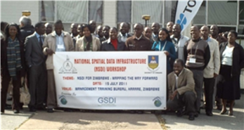
- Raising Awareness through National Workshops and Publication of an NSDI Newsletter for the Zimbabwe National Spatial Data Infrastructure (ZNSDI)
 The GSDI Association connects professionals and specialists interested in promoting international cooperation in support of compatible local, national and international spatial data infrastructure developments. Working on issues at the intersection of technological, legal, and socioeconomic concerns, it has attracted and applied the expertise and influence of leaders, practitioners and researchers in the fields of mapping and geospatial information management since 1996.
Make a Difference! Sponsor a Project!
Without the developing world, we cannot realize our vision of a Global SDI. Will you do your part to advance our global spatial data infrastructure and sponsor the GSDI Small Grant Program?
| Sponsor Category | Contribution | Sponsors up to |
| Map Sponsor | $ 50,000 US | twenty projects |
| Polygon Sponsor | $20,000 US | eight projects |
| Line Sponsor | $10,000 US | four projects |
| Point Sponsor | $ 5,000 US | two projects |
 The grants selection process is governed by the GSDI Societal Impacts Committee working through regional SDI organizations. All Sponsors will be recognized on the GSDI Web Site and in all literature and articles describing the GSDI Small Grants Program. Smaller donations also are gratefully accepted. To see what has been accomplished in the program to date, visit http://gsdiassociation.org/index.php/projects/small-grants.html. Learn more about Geoconnections here.
Find out more about URISA GISCorps activities, including their support for the GSDI Small Grants Program, by visiting http://www.giscorps.org and look at ‘Ongoing Projects’. Information on the FGDC international cooperation is available at http://www.fgdc.gov/international.
For further information, contact:
Project Leader: Brigitta Urban-Mathieux (This email address is being protected from spambots. You need JavaScript enabled to view it.)
GSDI Secretary-General: Roger Longhorn (This email address is being protected from spambots. You need JavaScript enabled to view it.)
GSDI President: David Coleman (This email address is being protected from spambots. You need JavaScript enabled to view it.)

